A spare week earlier this year so I decided to do the walk i said I'd never do...
I've crossed the WHW many times whilst on other walks and the constant stream of people on the way put me off, but I surmised that April should be a reasonably quiet time, especially as the weather forecast was for snow and north winds.
I enjoyed (sarcasm) the usual standing room only train journey from Aberdeen to Glasgow on the Friday afternoon as the rain, sleet and snow battered the windows, then a nice quiet 20 minute local train out to Milngavie where I was booked into the premier Inn. A last minute Tesco resupply trip and a steak pie supper (seriously, they dont do mock chop suppers down here, heathens) from the local chipper completed the preparations before i headed for an early night.
Day 1
Milngavie To Mallarochy
(20 miles)
Milngavie To Mallarochy
(20 miles)
Saturday dawned nice and sunny but with a crisp white frost freezing all the windscreens in the hotel car park, I headed up the road to the official start point in the town centre, half way there a car pulled over and asked me if I knew where the WHW start point was...


I never stopped at the Glengoyne distillery but I did nip into the Beech tree for a coffee break, well deserved after a nice easy and generally pleasant 7 miles or so. I was the only one in, athough a party of three left as I arrived, i have that affect.


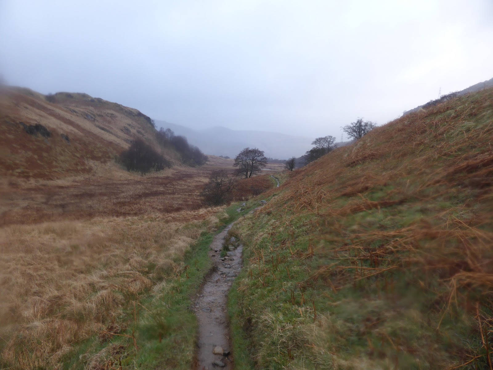
nearly at the bottom of Conic hill, daft gate still to come.


No complaints about the campsite though, £6.50 (I think it was) and a decent enough flat pitch, although the noises and goings on around 0300 were interesting listening.
Only 76 miles to go
Day 2
Mallarochy to Beinglas Farm
(19/20 miles)
(19/20 miles)
Another decent enough morning dawned, but there were a few ominous looking clouds scudding about by the time i finally set off to walk. Day 1 had seen me do about four miles more than planned so today I only had about 12 miles to do if I stuck to my itinerary.
 Lots of these short sharp wee climbs on the 1st stage up to Rowardennan, unfortunately with a short sharp climb, there's always a short steep downhill on the other side.


The next two miles up to Ptarmigan lodge were pretty flat easy going, the two after that were a constant steady climb to high above the Loch shore on forestry logging roads.
 Squalls were constantly coming down the loch, not enough to to go full goretex, but bloody freezing all the same.


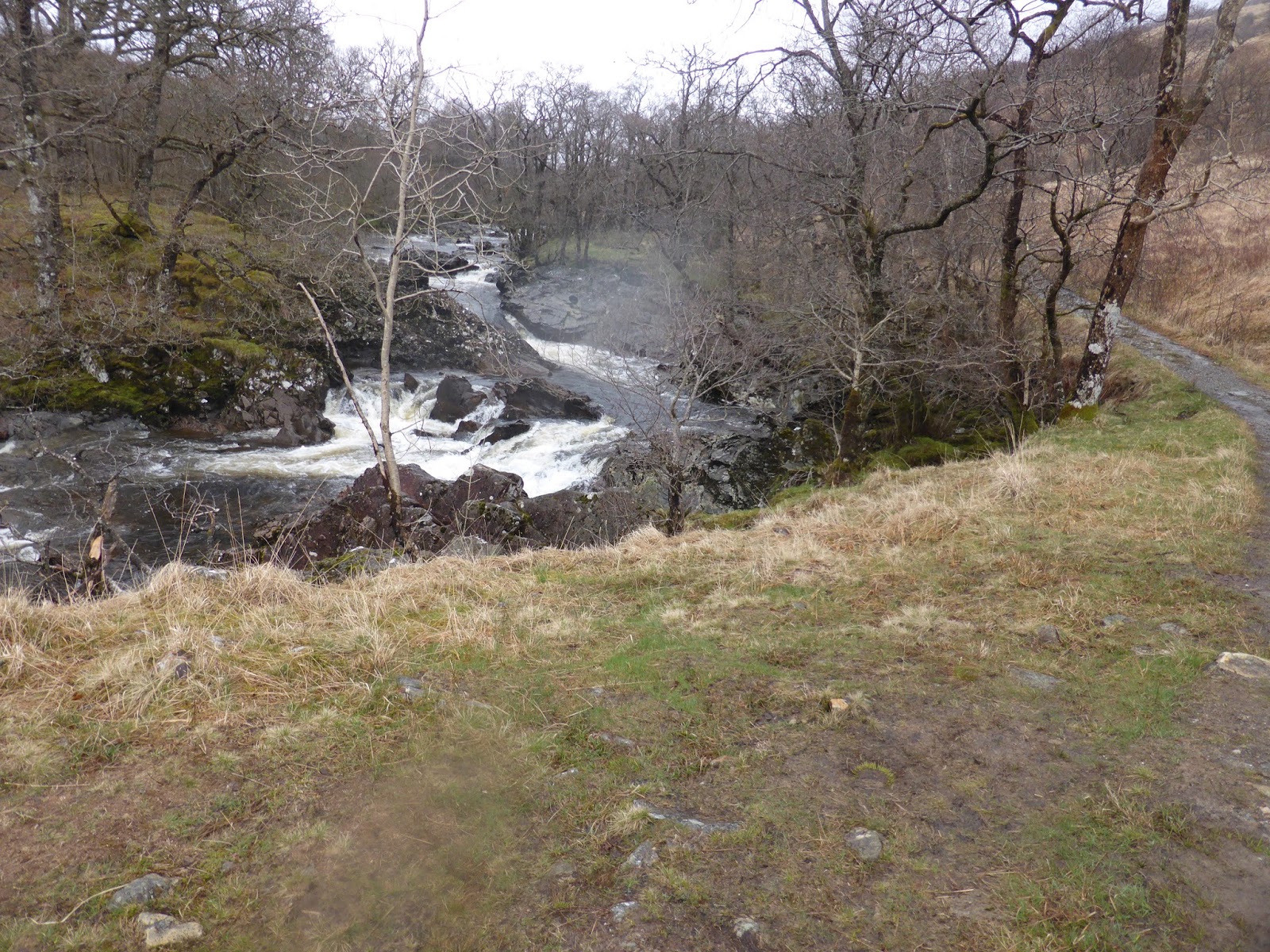
The logging road turned into a wee path, which was quite nasty in places, especially with it being wet, finally it started to descend down towards Caliness, we're my original plan had been to wild camp. It was only around midday, far too early to contemplate stopping for the day, so I continued on, passing an honesty box in the process which seemed to be selling Tablet (a fantastic instant energy booster). I didn't buy any, which I regretted almost immediately.
A mile or two past Caliness I arrived at the Inversnaid hotel, i had faint hopes of maybe getting a late bar lunch but as I walked past I couldn't see any signs for a bar and didn't fancy just walking into what I assumed was a posh gaff. I was told later that there is a bunkhouse half a mile up the hill that serves food and drink to mere mortals/smelly hikers, after half a day clambering over rocks, trees, roots and steps I probably wouldn't have walked a mile off route anyway TBH.
I walked a few hundred meters further and found some shelter behind a boat house where I fired up the wee kovea burner, some crackers and cheese with a double tomato cup a soup and added tabasco sauce fairly perks up a tired body.


And then it's back to clambering, hanging, tripping and scaling boulders.

Finally after a pretty un-enjoyable day, the end for the Loch is reached, this would be a pretty good wild camp spot, if you moved some litter. I'd already made my mind up to push on to Beinglas farm so just pushed through.
Soon you arrive at Doune Bothy, i did have thoughts on staying there for the night as it was now nearing 1800hrs, but it was full, so i kept going.
Now I'd read reports and seen YouTube clips of people getting lost on the WHW, I'm at a loss on how that can be achieved tbh, as I've never walked such a straightforward, obvious route.
But (big but) if one was to be navigationaly challenged, 300 meters before the bothy would be the place for it to happen. As you reach the top of a rise the path goes through a bit of a mud bath, you can see an obvious path leading (to the right) out the other side, you can't really see the other (correct path on the left), i wasn't confident that the obvious path was the correct one and had a deek about, catching sight of the correct path i soon got on it, after about 20 paces the bothy appears below to confirm your "correct" choice.


A late night after a very taxing day, in the sleeping bag and out cold for 2130. Another near 20 mile day, only 56 to go, i was now 8 miles ahead of my planned itinerary, a good bonus to carry into day 3.
Day 3
Beinglas farm to Tyndrum
(12 Miles)
An overcast morning with a bit of drizzle today, once I was packed and ready to go I nipped into the bar for a bacon roll and coffee, a good start to any day.
The original plan for day three should have been to walk from a wild camp at Caliness to Auchtertyre camp site, around about 16/17 miles, but I was quite a few miles ahead of schedule and Auchtertyre was only about 10 miles away, either a short day or push through to either Tyndrum or Bridge of Orchy, decisions, decisions.

The first mile or so after the farm were nice going, a very slight incline and the weather seemed to be improving, as you move up the glen the busy main road on the other side gradually gets closer and you become a lot more aware of it.

Not long into the trip there was a section with detours. (around about the Falls of Falloch) I think it was something to do with a hydro build, but TBH I was paying more attention to the path as it was a bit confusing, a lot of the signs and safety tape had been blown over, I could see the end of the detour and I ended up just going straight for it, no one seemed to care.
Not long into the trip there was a section with detours. (around about the Falls of Falloch) I think it was something to do with a hydro build, but TBH I was paying more attention to the path as it was a bit confusing, a lot of the signs and safety tape had been blown over, I could see the end of the detour and I ended up just going straight for it, no one seemed to care.

Looking back, after a steady climb, the road on the other side of the glen can just be made out in the trees.

Top of the first climb and a good view ahead, nothing strenuous and a nice early leg stretch to get warmed up, there is another short climb around about Derrydaroch (more Hydro works here, but not on the track this time)

another mile or so and you cross a bridge and start walking on the north bank, the path here goes alongside the river and through areas with livestock, they were friendly

Route ahead


where we've been

And just around the corner

You reach the railway underpass, the photo doesn't do it justice, it is really quite low at the other end, especially with a bergan on. Normally I would have taken the bag off and dragged it through, but the cows obviously use the tunnel as a shelter and it was thick with mud and stuff....
After the underpass there's a short 100 meter or so section of old tarmac, then you go under the main road (A82) via a big, purpose built tunnel. Almost immediately there's a short but steep scramble up a wee hill to join the old military road that contours the hill for a mile or so, in some places it's very good going, in others it's a bit of a bog fest, especially around a couple of gates you need to pass through.

It's not the most unpleasant of walks though, and after the first 5 minutes your well away from the road, so its peace and quiet again. The track eventually reaches a viewing area and track junction. If you turn right (east) and go down through the woods for half a mile you would find yourself in Crianlarich, handy if you wanted to resupply, stay over or even bail out. There's a train station for the west coast line and quite a regular bus service.
 View back down, the path is slightly better the further up you go. Roughly down where the trees are, there was a section that you basically had to scale along the wall, ala spiderman for 20/30 feet to keep out of a huge puddle/mud bath, this is April, it's still a tadge wet, summer/3rd week in July should be a lot better...
 Crianlarich is directly through the trees and down in the glen

Looking back down to the view point/track junction, the WHW comes in from the right, the Crianlarich path is the one that disappears into the woods. I had a slight misjudgement here, I thought that was the top of the climb, turns out there was still a good steep section still to go

The top and mair dubs
 After reaching the top, you spend the next hour or so winding your way back down (and up, often) towards the road, your in the woods the whole way, some of the downs are steep, as are some of the ups, but they're all short and sharp and its not to unpleasant.
 After re-crossing the A82 follow the path across a field or two and onto a bridge over the river Fillan.

Easy walking on a farm track from the river soon brings you to Auchtertyre, camping, wee trolls houses and a well stocked shop here, initially i had planned to stop here but as per every day so far, it was just a bit to early. i did stop for a bacon roll and coffee though. I sat in the sun eating and in no particular hurry, but the wind was quite cold so i didn't take as long chilling as i wanted.
After the underpass there's a short 100 meter or so section of old tarmac, then you go under the main road (A82) via a big, purpose built tunnel. Almost immediately there's a short but steep scramble up a wee hill to join the old military road that contours the hill for a mile or so, in some places it's very good going, in others it's a bit of a bog fest, especially around a couple of gates you need to pass through.

It's not the most unpleasant of walks though, and after the first 5 minutes your well away from the road, so its peace and quiet again. The track eventually reaches a viewing area and track junction. If you turn right (east) and go down through the woods for half a mile you would find yourself in Crianlarich, handy if you wanted to resupply, stay over or even bail out. There's a train station for the west coast line and quite a regular bus service.
 View back down, the path is slightly better the further up you go. Roughly down where the trees are, there was a section that you basically had to scale along the wall, ala spiderman for 20/30 feet to keep out of a huge puddle/mud bath, this is April, it's still a tadge wet, summer/3rd week in July should be a lot better...

Looking back down to the view point/track junction, the WHW comes in from the right, the Crianlarich path is the one that disappears into the woods. I had a slight misjudgement here, I thought that was the top of the climb, turns out there was still a good steep section still to go

The top and mair dubs


Easy walking on a farm track from the river soon brings you to Auchtertyre, camping, wee trolls houses and a well stocked shop here, initially i had planned to stop here but as per every day so far, it was just a bit to early. i did stop for a bacon roll and coffee though. I sat in the sun eating and in no particular hurry, but the wind was quite cold so i didn't take as long chilling as i wanted.

wee bird mooching for crumbs
 yet another crossing of the A82 soon after leaving Auchtertyre, and your soon walking alongside the river Fillan again
 i presume a previous WHW walker lost his sword here, pretty careless
 how do you loose a sword in a loch.
not long after the loch, i arrived in Tyndrum, quite a busy wee place, loads of camp sites, hotels and those wee hut things for dwarfs.
I nipped into the pub/hotel for a Guinness,or three and decided to have a meal as well, very nice it was too. the walking was obviously done for the day so i headed off to get the head down.
not the worst of days walking ever, pretty short section for me, there had been some nice bits, some too near road bits and a couple of nice snack stop bits.
Day 4


not long after the loch, i arrived in Tyndrum, quite a busy wee place, loads of camp sites, hotels and those wee hut things for dwarfs.
I nipped into the pub/hotel for a Guinness,or three and decided to have a meal as well, very nice it was too. the walking was obviously done for the day so i headed off to get the head down.
not the worst of days walking ever, pretty short section for me, there had been some nice bits, some too near road bits and a couple of nice snack stop bits.
Tyndrum to Kings House
(19 ish Miles)
Another early start, I nipped into the green welly (i think it was) for a quick breakfast snack and coffee, i sat outside with my coffee and watched the village come to life before heading out and back onto the trail.

After climbing up and out of the village the day was looking like it might be a cracker, the sun was burning off last night's moisture and everywhere you looked there was steam rising. Most of todays walking would be on the old Military road

Beinn Odhar and Beinn Dorain in the distance The railway line and the path stick pretty close together for the first 4 or 5 miles today. this is the first of a few crossings in the first 7 miles


a look back towards Tyndrum,

Beinn Dorain with the last remnants of snow, a lot of the hills still had a good covering on their eastern faces, this is a short section of maybe a mile where you leave the military road and contour the lower slopes of Beinn Odhar

nice walking, everything today is straight


nice walking, everything today is straight

oops

sink hole on the WHW, with bypass in place, bridge of Orchy in the background, where we pass under the railway and head off up hill

after Bridge of Orhy its time to climb again, quite a cheeky climb TBH, especially with a full bergan and 7 miles already under the boots.

just about at the top of Mam Carraigh, its been a good climb, all the way from Bridge of Orchy

On top of Mam Carraigh, about to decend to the Inveroran Hotel

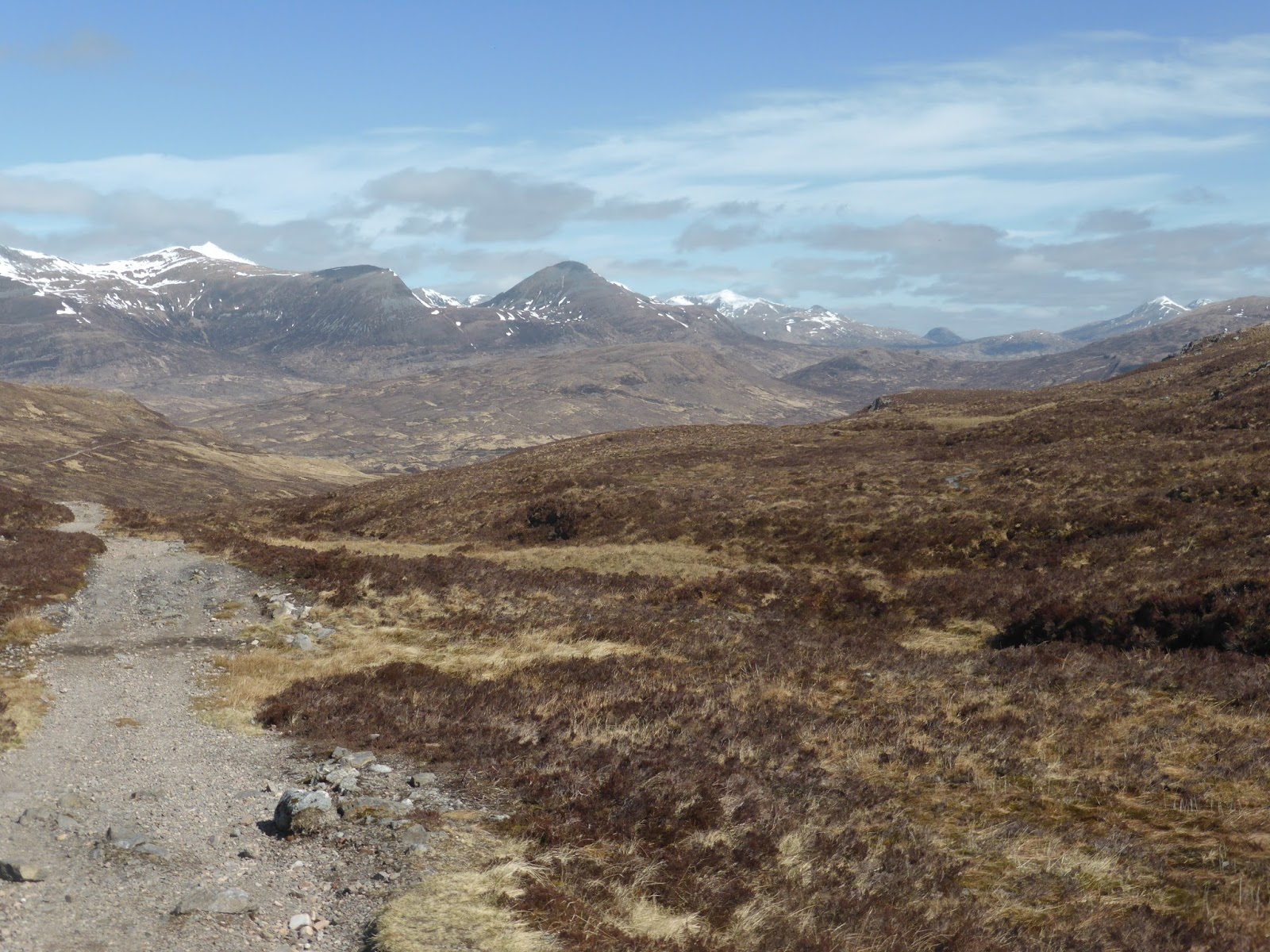
West end of Loch Tulla, the WHW runs above the lower tree line and climbs steadily (disappearing away to the right), before dropping over into Glen Coe

you can just make out the Inveroran Hotel, all downhill from here to the bar

the hotel, roughly about 9 miles after leaving Tyndrum

the hiker bar for a very very refreshing pint of ice cold Crabbies

you can just make out the Inveroran Hotel, all downhill from here to the bar

the hotel, roughly about 9 miles after leaving Tyndrum

the hiker bar for a very very refreshing pint of ice cold Crabbies


leaving the Inveroran Hotel, the hotel is famed for its semi tame Red Deer visitors, this one was hoping for a snack.
The walk follows the road (dead end) for about half a mile, ending at Victoria bridge.

back on the military road and heading over what is possibly classed as the edge of Rannoch Moor, there's quite a long drag up hill from Victoria bridge, but when you reach the top its quite easy going, the cobbles can be an irritation underfoot, hence why there's a side path developing


one of the down sides of hiking military roads, they're pretty straight,

eventually though you reach something, anything will do to break up the long straights

eventually though you reach something, anything will do to break up the long straights

still plenty snow about. Glen Coe moutain still had the ski runs going and they looked busy.

Eventually i reached the Kings house, i crossed the burn and found a decent pitch within walking distance of the hotel climbers bar, a long day but made better by a boil in the bag meal and a pint in the bar. View from tbe Scarp was pretty decent.

Braw
The end of an another long near 20 mile day, the best day of the walk so far, especially after you get past Bridge of Orchy, the sights open up, there's barely a road of note (a couple of crossings only), looking forward to the next two days.
Kings House Hotel to Lairigmor (Via Kinlochleven)
14 odd miles
Awoke to a very frosty morning, i had pitched my tent in just the right spot (unintentionally) the sun was beating down on me and defrosting my tent, others near the trees and bridge (in what looked the best spots) were frozen solid.
after a light breakfast i quickly packed up and took the track along to the foot of the devils staircase, it looked like it was going to be fun...

view back down from high up on the devils staircase, possibly the start of the zip zags?
Quite a few folk passed me going up, but i consoled myself with the fact the majority weren't carrying anything bigger than a day pack, I'm to tight to pay for someone to drive my bags from point to point. I can see how it appeals to a lot of folks who through all sorts of circumstances probably wouldn't do the walk if they couldn't use the transportation options. I like the flexibility of stopping where i want, not where my bags are
sat on top and had a chat with a lad who was training for some mad race, fort william to

over the top of the devils staircase and the long descent to Kinlochleven begins, i really enjoy walking on this type of path
big sky, big views

a steeper section, the path is easily seen winding its way down and around

a view break, Kinlochleven just visible down in the Glen

Gleann Lolairean leading off the bottom left from the Blackwater, just 11 months prior to this picture and while on a cross Scotland Challenge (TGOC) my wife and i were stranded for a night at the mouth of the wee burn you can just make out entering the Loch. 36 hours of rain had swollen the burns into raging torrents, a night in the tent and the next morning the river was no more than a wee burn again.
Although you cant see it in the picture, there's a huge dam hidden behind the wee hill, you can just see the top of one of the towers, beyond the dam is proper back of beyond, civilisation is about two days walk, 4 or 5 for any sort of resupply options


the WHW track eventually joins up with the maintenance road that goes up to the Blackwater dam for the final mile or two into Kinlochleven

probably my most enjoyable day, proper hills and good hill tracks for most of the morning, barely any road and fantastic views.
First stage of the day done (8 or 9 miles), once in the village i headed to a local bar where i enjoyed a long leisurely lunch which was most enjoyable, only 4 miles to go to where i hoped to bivi up so no rush, the majority of folk i spoke to were stopping in the village, so a really early finish for most. before leaving i decided to pay a visit to the COOP for a final resupply

the climb out of Kinlochleven, (very cheeky) and a look back down to the loch, the pap of glencoe on the horizon.

and back towards the village

further up, a couple of hours earlier i had come down the right hand side of the Glen directly opposite, you can just make out the pipes that run up the glen.

Lairigmor (an old ruin/Sheiling), the glen itself was peace and quiet central and without doubt the best pitch of the trip, i'd only seen two other people since leaving Kinlochleven.

as the sun went down it got rather nippy, down jacket and beanie on while knocking up a boil in the bag culinary delight to end what had been a very satisfying day
Day 6
Day 6
Lairigmor to Fort William
10 miles
10 miles
Scotland in April, a bit of altitude and a shaded glen sets it up nicely for a bloody cold frosty morning


The walk out of the glen was a bit longer than i realised, i was glad i hadn't stopped in Kinlochleven yesterday as that would have added another 4 or 5 miles onto the glen today.
After leaving the glen, there's quite a bit of up and down bits, eventually you enter quite a bit of for forrestry, the path is very good the whole way.


the end of the WHW is a bit of a disappointment in my opinion, after coming down from the hills, your left with a 2 or 3 mile walk into town, alongside what becomes a very busy road, i couldn't be bothered walking to the official finish at the other end of town and only walked as far as the train/bus station, had a huge burger met my lift home and headed through to Aviemore for a night out.
the walk was ok, the last 2 1/2 days were really good, i wouldnt want to do the Glasgow to Loch Lomond to Tyndrum bits again, mind you the way it's going with the loch Lomond park authorities I expect walkers to be banned soon if they don't buy a #LLTNPA 'r' Ace T shirt and camp where they're told (at a premium price of course).
No comments:
Post a Comment