About the Loon

My photo
A happy chap who likes a walk every now and then

Wednesday 26 November 2014

Visit Scotland, See the Sights (or sites as its becoming)

I love Scotland, there’s no two ways about it, for me its the carlsberg Maccallan of countries, im also a rabid nationalist and proud owner of a natty wee yes badge, so Che McGuevara it is.

Warning political rant starts
For me I see no point at all in a country being managed by another, you wouldn't give your monthly budget to your next door neighbour and rely on them to manage your household, would you?
Political rant ends

But, the current policies regarding the industrial destruction of the most beautiful wild lands in the world really does question my blind loyalty to our political masters

This wee post was inspired by stumbling upon this informative site visitscotland windfarms  please give it a visit and support if your of the same opinion, if not its still worth the read

If truth be told, although i dont believe the ridiculous propaganda in relation to their output, I personally dont really mind them in the right place, between Aberdeen and Huntly there's loads of them along side the main road, its farm land anyway. But please leave the great wilderness areas alone.


Che

Monday 17 November 2014

The TGO CHALLANGE 2014.....DAY 13 (Windfarms and Fish Suppers)


Day 13
Spittal to Fetteresso Forrest 12 miles


A very early rise, due to the early and unexpected onset of sleep the previous evening


The early morning mist was just starting to burn off as I packed the gear away and wandered along to the bridge over the water of Dye, from there it was onto the B974 at the ruin of Spittal Cottage,  immediately after hitting the road theres a short, sharp climb until it flattens out after a hundred or so meters, about half a mile further along the road you turn into the forest. The next mile or two is a gradual climb up through the forestry plantations, nothing taxing, especially after becoming reasonably walking fit since leaving Mallaig. 


After a couple of miles you round Tire Begger hill and the skyline changes somewhat, where once upon a time you could turn right and head down through patons den, now profit margins forces you left onto the Builig heritage path north.

 To be honest that shouldn't have been to much of a problem as its probably an easier route overall,  the Builig is well marked on the map and even signed on the ground, unfortunately there aint really no path, there are a couple of marker posts randomly placed/sunken in various parts of the swamp which you notice as you trip over them, they were pretty much no help whatsoever, apart from the one you can walk along....

 Its probably only quarter of a mile from the track end to the wood, but it was in my opinion worse than the bog/swamp at sourlies, this one is waist high vegetation, with big hidden drops into holes or burns, the safe looking flat bits are constructed of floating vegetation that didn't take kindly to a wee fat chap standing on it. To cap it off, the sun was absolutely beating down on quite possibly the hottest day of the year so far, my previous good mood was disappearing as rapidly as my legs were. When i finally (probably only 20 minutes in real life) made it to the wee burn just before entering the woods, I sat down and spent a good 20 minutes cooling off and replenishing the liquids lost.

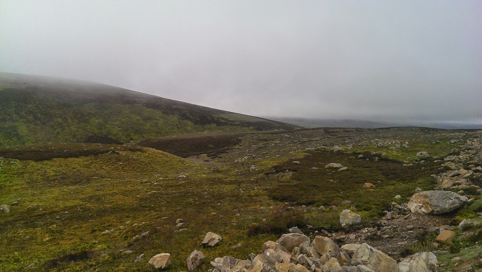
After sorting myself out I found something actually resembling a path and headed into the dark narrow passage through the pines, initially its pretty muddy but as it rises in dries out into a decent trail, before you know it you pop out onto a wide logging road, I hadn't really taken much notice of the gradient here before, but the climb straight up Kerloch is what known in the trade as a bit cheeky, especially on a hot day.

Taken from about half way up the climb to Kerloch top, I obviously decided a photo stop was a good excuse for a five minute breather, being as I was breathing from the wrong end by this stage

From the same spot and starting to appreciate the scale of the new windfarm as I slowly get above it.

Roasting hot day, climbing the east coast everest while carrying my hoose and still wearing a softshell,  must be soft in the heid, nice glasses though.

Another break, pretty much at the top of Kerloch and looking down on the industrial wasteland below, there’s loads of turbines,  and loads of work in progress on piles more


Looking back away across to the cairngorms

Just around the corner and thats the last hill of the 2014 challenge done.

Going down from Kerloch is a bit of a pain on the feet and knees, the track has obviously been washed out a few times, resulting in large unstable rocks being the main underfoot surface, its also quite steep, my dodgy footwear/slicks didn't help much either.  Halfway down I met a minister coming up, wow, I know I had maybe accidently sneaked the lords name into various blasphemous sentences while swimming the Builg path, but surely that didn’t merit the god squads mobile incident unit. He pulled me over for a wee chat and surprised me by asking if I was on the challenge, bugger, it was looking like a report would be sent to the procurator at challenge HQ afterall, but just as I started to think about dropping the bergan and running away he mentioned that he was something to do with St Drostins in Tarfside and was well aware of the 300 odd nutters who went out for a walk 13 days previously,. After our wee chat I continued down the hill, slower than he was going up it, that cant be right, I bet he doesn’t get wet feet at the Builig either...

Soon enough the hill levelled out at the bottom and I made good progress again through the forest, crossing a wee burn you could make out where quite a few tents had been pitched the previous night, there aren't too many decent spots in the forest for multiple tents, this is one of the better ones. It is also the spot i had debated pushing onto the previous day, rather than the scuttering about in Glen Dye i eventually settled on. The previous nights occupants were probably hammering the Stonehaven clubs by now, ach well, my turn tomorrow,  maybe.

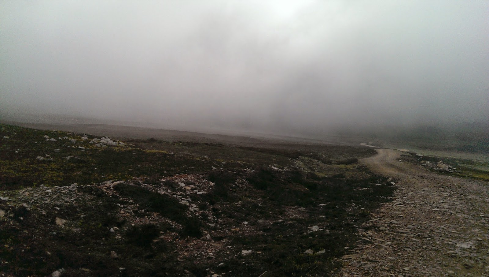
A wee bit further on I came to the "main" Fetteresso thoroughfare, from previous experience I knew I had to pay attention here as there's all sorts of vehicles scooting up and down between the Slug road and the windfarms, thankfully they were all strictly adhering to the well posted speed limits (does sarcasim work in the written word?). As i walked I was passed by a few big fast things and some small fast things, i haven't a clue what they were as I couldn't see anything through the clouds of dust, i employed a buff as a makeshift shemagh, at least I hadn't carried it all this way for nothing.

I had previously earmarked a large track junction just short of Stonehouse as my chosen last night spot, just over the burn and up an embankment there's a grand spot hidden about 100m from the track that would be dandy for maybe two or three shelters. I arrived covered in dust but otherwise in fine fettle .

I sat on a big tree stump beside the burn and scoffed a melted snickers while having a reasoned debate with myself, it was only just after lunch time, it was only about seven miles to Stoney, i was feeling good although still sweating like a stuck pig in the heat, I also knew there wasnt another hill between here and the coast. I just didn't see the point of getting the tent up and doing nothing for the rest of the day, but I knew if i kept going i would definitely have to go the full distance tonight, if i kept taking in plenty water it shouldn't be a drama and my own bed had a certain appeal.


Day 13 1/2 Fetteresso Forrest to Stonehaven  8 1/2 miles


The debate didnt take long, I re slung the bergan and headed down past Stonehouse and alongside the cowie burn, a burn that empties into the north sea at Stonehaven, that thought further emphasised how close I was to the end.

There are a few routes from the Stonehouse area to the Stonehaven corner of the Fetteresso, the majority are pretty convoluted, there’s no such thing as a direct route anywhere in the forest, I had tried all variations when planning the challenge and have wandered a few of them during training walks, the route I had put on my route sheet involved one of these variations, but I made a snap decision to just follow the most straight forward one, even though it would entail a wee bit more walking on the road later.

As I wandered down the track I stopped a couple of times for water refills from the burn, it was coming out as quick as it was going in, just before I left the riverside track I filled the bottle for what would be the last time. A few hundred meters after leaving the burn the track winds its way through the stables at Mergie turning gradually into a tarmac surface. Another couple of hundred metres further on this little road joins the unclassified road that goes all the way to Stonehaven.

I gained the road and sat (more collapsed in a heap tbh) down in the shade of a tree to enjoy a drink and some boilies (sugary morale raising sookin sweeties), just as i was getting comfortable I heard voices approaching and looked up to see the Austrian duo of Markus and Philipp appearing around the corner, i had last seen them at Loch Treig on day four. They had come in off the Slug road, crazy loons. I come out in a rash just driving along it, bugger walking alongside it as every mentalist from Stonehaven south uses it as a racecourse, to cut over onto the North and South Deeside roads avoiding the southern routes into Aberdeen.

They looked how I felt, which was another instant morale booster (is that bad), they were also out of water so we shared my bottle before we all headed off together on the road to the sea, for the next three miles I walked faster than at any time on the challenge, we fairly raced along the road and I soon found myself in the middle of three folk trying to re-enact the retreat from Stalingrad, the lesson I learned from this is never ever promise to buy anyone (especially thirsty Austrians) a pint at the station bar when we get there. We did stop briefly to chat with a wifie at the Spyhill stables and drink a bit more of the water, then it was back to hammering the last few miles on tarmac

As we tabbed along the road I decided to make a call home, id be needing a lift in a couple of hours and I wasnt meant to be finishing until tomorrow,  hopefully the taxi driver was in or it was a train home, thankfully there was no dramas and we arranged to meet later in a fine Stoney establishment of ill repute.

The best stop of the trip, just on the edge of Cheyne hill where we got our first view of the north sea, it felt fantastic,  it was done as far as I was concerned,  a wee walk down hill (ok 3 miles to the sea) into Stoney to complete the formalities and grab a drink or two. There is a handy wee path just here that goes down past a row of houses and deposits you out beside the garden centre on the outskirts of town. I really enjoyed this bit and life came back to my weary body, we took the flyover over the dualer and headed down to the Station bar.

Ten minutes later we were safely ensconced in the beer garden of the Station, its now a proven scientific fact that one pint of Guinness = 10 litres of water and boy did it feel like it. A few locals came out to chat and use the smoking area, Markus and Philipp sparked up obscenely huge ceegars and it just felt so good sitting there I didn’t want to move. Unfortunately I wasn’t finished so I said my farewells and headed off through the town to the harbour, the two lads were going to head down later, the ceegars were probably good for another two hours at least.

I was still on cloud nine walking through the town and took a couple of the back lanes, popping out beside the Carron chipper (home of the deep fried mars bar and now the deep fried snowball), it smelt ace, unlike myself, across the road and two minutes later im at the harbour, last time I was here they were throwing fireballs into the sea after the famous new years fireball procession. 

Today the tide was in and I wandered straight onto the sand and into the water, trying not to look like a complete nutter to the folk around about enjoying their ice creams, a couple of feet in the water pictures and it was back to dry land.


End boots in the North Sea.

A recap of start boots and the Atlantic

And a final view back to Stonehaven from the Bay Chipper

Thats it

TGO 2014 FINISHED

What a really odd feeling, I think I would have quite happily turned around and walked back to Mallaig, there was a kind of anti climax now that it was done, I think I was actually gutted to have stopped, the last couple of miles had been a great feeling but now that it had ended I didn’t know what to think, well I did actually, as 1 pint of Guinness = 10 litres of water I went and got a rapid 50 litres of Guinness flavoured water into me. My lift turned up and treated me to my supper, and an afy fine fish supper it was from the Bay chipper, seemingly the best chipper in the world (google it) I probably lost them a few customers that day, as I got the “your fairly reekin” message passed on while queuing.


As an aside My better half had been baking when I called earlier, as she expected me to finish the next day she had been casually making a cake to celebrate the crossing, me calling for a lift had thrown the cat amongst the pigeons for a couple of minutes but as usual she came out with a master piece before coming to collect me, when we got home it was there waiting, its now long gone now but the topper she made for it capped the whole walk off for me, although a wee bitty of hair might have been nice.


Friday 14 November 2014

The TGO CHALLANGE 2014.....DAY 12 (Glen Dye and the Buried Treasure)

A Gordon for me, a Gordon for me, 
If ye're nae a Gordon ye're nae use to me. 
The Black Watch are braw, the Seaforths an a' 
But the cocky wee Gordon's the pride o' them a'.


Day 12
Tarfside to Spital (Bridge of Dye ish) 11.5 miles (12 1/2 with a secret mission detour)


When planning the route I was determined to go through Glen Esk for old time’s sakes, but I was just as determined that I wasn’t going to do the road walk from Edzel to the coast. So I actually planned this stage of the route first, with Stonehaven being the end point as you can get to the coast with a very short road walk on the final leg, after deciding that I wanted to start in Knoydart I just joined the two points together in some weird convoluted route that seemed to work out just dandy.

 After packing away and a partaking in a relaxed breakfast I headed off up the wee track to the side of the Masons, within minutes I was out onto the open hill behind Tarfside with a lovely view back down into the Glen. After seeing the mess of new tracks on the estate the previous day I was a wee bit apprehensive, as things turned out there were no real worries and the tracks were easy enough to navigate and didn’t really differ to much from my map, I think I was away pretty early and never saw anyone either in front or behind at all, quite amazing considering the amount of folk that had been in Tarfside the night before, I presumed they had decided to follow the River Esk down to Edzell or were having a morning after the night before break.

My first wildlife encounter of the day was a hillside covered in cattle, I could see them a good bit away and down from me so just continued happily bowling along the track, as I came around a wee dip and corner there were dozens of them all over the track in front of me, loads of calfies and their mums. They weren’t for moving and were giving me the evil eye, so keeping as far from the calves as possible I wandered between them while keeping up a pretty one sided conversation. I reckon ive now had more conversations with cattle and sheep in the last two weeks than I have had with people, they seem to understand me, maybe we are on the same level.


Leaving the coos behind I gradually wandered higher up the side of the glen until I was looking down over the Burn of Mangey, what had been a really nice morning turned a bit chilly as a low cloud blew in hiding most of the glen above and below the track. I had been walking in just a base layer so i pulled over and chucked a soft shell on to keep the chill off, (less weight in the bergan too) the low cloud was swirling about on the light breeze and never came to anything navigationally challenging. A mile or two further on it disappeared completely leaving a fine day in its stead

With the day clearing and the piece and quiet of the glen I was fairly enjoying myself, it’s very much a working glen but I still hadn’t seen any sign of life or any fellow challengers for that matter… 

Walking through Broomfauld and Wester Aucheen was easy going, at Blackcraigs I could see a Collie dug sleeping just off the track past the gate, im a “wary of random dogs” guy and approached the gate thinking “can I sneak by” , “no you cant” was the answer, as I slipped through I was met by the oldest dog in town I reckon, It came over for a sniff and we got on quite well after that, the obligatory belly rub (I think he wanted one to) and we were the best of pals, a younger dog appeared from somewhere but he paid me no attention what so ever, guess im becoming a regular Dr Doolittle.

The house I lived in as a young keeper was just down the track a bit and the farm at Blackcraigs still holds fond memories of years gone by. In the spring after the lambs were born we would head up to the pens at Blackcraigs for a couple of days to help the Shepherd square his flocks away for the summer, it seemed to me it was more a social event for the estate with some bloody hard work thrown in, we would turn up, work on the lambs giving inoculations, put rings on their bits (scary thought for most of us males) and tails then catch and coup the ewes for the shearer, lunch involved big sandwiches, big pies and beer, supper involved tattie soup, stovies and gallons of whisky, breakfast was a blur. If your ever passing have a look high above the house door, there’s a couple of obvious spots that have been repaired, I was amazed to see them still there, the Shepherd at the time heard geese flying low over the house one dark winters night, thinking xmas dinner was being delivered he ran out side with the gun, saw the geese silhouetted in the night sky and let rip with goose shot, forgetting that the house was in the way.

On top of Stobie Hillock, looking back towards Tarfside.

After leaving my new best friend to go back to sleep, I continued on along the winding hill farm tracks through Blackhills and down to the wee Hazel burn, the weather had warmed up again and I decided to stop for a 10 minute chill out and a water refill. I then followed the burn down a wee bit before cutting across some fields and back onto a LR track, from there it was a straightforward but bloody cheeky wee climb up Stobie Hillock, when I looked back from the top I finally saw fellow challengers dotted around on various tracks below, all making their way gradually to the same point.

During my route planning phase I had planned on following a line of butts down off the Stobie into glen Dye, there’s always some variation of a path beside grouse butts, so I assumed it would be any easy route down, but when I actually got up on top I discovered it was very easy going, the heather had been burned off at some point leaving fine underfoot conditions, a quick change of plan entailed just following the old fence line up and over the peak until I reached the deer fence, I knew it was there and had thought it might cause a problem, in reality it turned out to be a really easy obstacle to get under, I arrived by pure chance at a corner section and there was a huge gap right on the corner point, bergan off and I just needed to crouch down on hands and knees to get through.

A combination of heather bashing and following the peat hags took me down and out at a small set of butts just at the head of the Glen Dye track, the Gruiggal of Dye was quite a steep wee cutting that required a wee bit of arse slidding (or scrambling in posh walkers parlance) on the 7 foot heather trees, it obviously hasn’t been burnt in there for a few centuries. I think I was just a bit unlucky on where I had aimed for as a crossing point, either higher up or lower down would probably have had a less steep gradient to negotiate, getting out was no problem as the path by the butts started right in front of me. Back on the track I opened the legs right up and fairly rocketed down the glen, rocketing for me only means that those behind catch up a wee bit slower.

 Before long I arrived at Charr bothy, and a busy wee place it was today, an afy fine American couple (please don’t be Canadian) were sitting outside enjoying the now glorious day, they had also come over from Tarfside, I hadn't seen them in front at all so there goes my “I was away early” theory. I think they were planning on pushing on into the Fetteresso before their last day into Stoney tomorrow.

Inside the bothy, there was a rather dedicated couple who were busy painting the place, its absolutely fantastic that folk give up their free time to look after these places in the middle of nowhere, mountain bothies are a walkers god send on shit days, even if its only for a five minute respite, if anyone has ever been to Charr bothy they will know that its always immaculately kept and a joy to visit.

 I sat down and chatted to the American couple for a wee while before they moved off on their next leg, hopefully it wasnt because I took my boots off and got really comfortable, I only had about three miles to go and it was only lunch time so I went into full chill mode having a very decent lunch and a couple of brews for good measure, quite a few other challengers also appeared, had lunch, chatted and departed to all compass points.

Eventually I decided to head down to my pre planned bivi spot, on route I had a good chat with a lad who was up repairing a collapsed bit of track, we talked about the local eagles and the money that had been invested back over the hill on the Glen Esk grouse moors.

The roof of Charr bothy just peeking up after eventually putting my boots on and making a move further down the Glen towards my camp site. The track heading off to the left takes you over to the clatterin brig and Glen Saugh.

The granite tor on top of Clachnaben, I was just wondering past today, but its a wee hill I enjoy utilising in a circuit I often do, from up there you can easily walk along the tops to Mt Battock, add in some boggy walking and peat and you can go all the way along to Mt Keen if desired.

Washing out to dry
On one of my walks I discovered loads of prospective camp sites along side the water of Dye, in hindsight I should probably have pushed on, If I hadn't faffed around at the bothy I would have been here about lunch time and Stoney is only about 20 miles walking, I think in my planning i was a bit to cautious, lesson learned though.

On the plus side there was a perfectly valid reason id chosen this area to stop over in, half a mile away there was a bridge and across that bridge there was a wood, and in that wood there was a cache and in that cache there was a bottle (E I E I O).

 A week previous to the Challenge my final build up wander had been in and around Glen Dye, I decided to stash a bottle of South African Pinochet (£3.99 in Lidl) and some vacuum sealed meals/snacks to get me through the last two days.

After I sorted out the accommodation I wandered down to the bridge to recover the goodies


As I crossed the bridge i noticed flowers under a tree on the far bank, intrigued I went over for a closer look, ive been coming here for ages and crossed the bridge numerous times but I had never noticed the cap badges on the tree before. The Gordon Highlander one is the local (now 4 Scots) Regiment, the very one I joined in the late 80s, being one of the very very few still serving suvivors of the Regiment I found the scene quite moving and had a wee moment remembering friends no longer with us. Its a fantastic place for a subtle memorial, I can visualise it being someones favourite spot, sitting against the tree watching the burn and hills on a fine summers evening.

Eventually I moved on to the wood of gifts, when I worked my way in to the tree I had used as a marker I started digging around for my bag, unfortunately some thieving bugger had been there first.... nae stash, absolutely gutted.

After cursing the world and wishing hell and damnation upon all, I glanced at the next tree over, this one actually had the really secret mark on it that I had made to identify it, what a great idea, if only you remember you had done it, Whoo hoo, spirits rose rapidly and within seconds I had the gear, so happily muching a snickers I wandered back up to the tent.

Because it was such a nice afternoon, I decided a bath was also in order prior to supper and a fine glass of red. I went up to the track and checked there were no easily shocked challengers heading my way, with the coast clear looking it was back down to the burn, strip off and straight in a lovely big pool, i even took the time to give the smalls a good dicht too, The water was pretty warm tbh and so refreshing.

Feeling great I had a huge supper and promptly fell asleep without even opening the wine, I never did drink it, I ended up carrying the bloody full bottle all the way to the finish, another bloomin daft idea that turned out to be then.


Day  12 Thoughts and impressions

a very easy day but to short, dont bury wine, its a waste of time, dont drink from the water of Dye for a while.


CLICK FOR DAY 13


Wednesday 12 November 2014

Oh Dear

Best get a gildi on and finish the last two days for the 2014 write up, now that ive been lucky in the draw for the 2015 Challenge.

Ive had the route planned for about two months with an Oban start, think ive got my priorities arse about face somehow